
Nano Sapien
NZs Milford Sound, Piopiotahi rocked by multiple large earthquakes at very shallow ‘depths’.
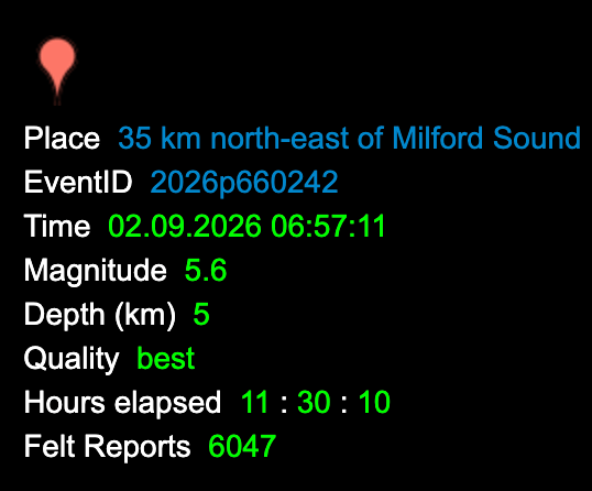
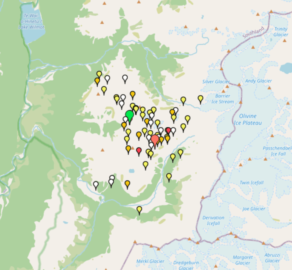
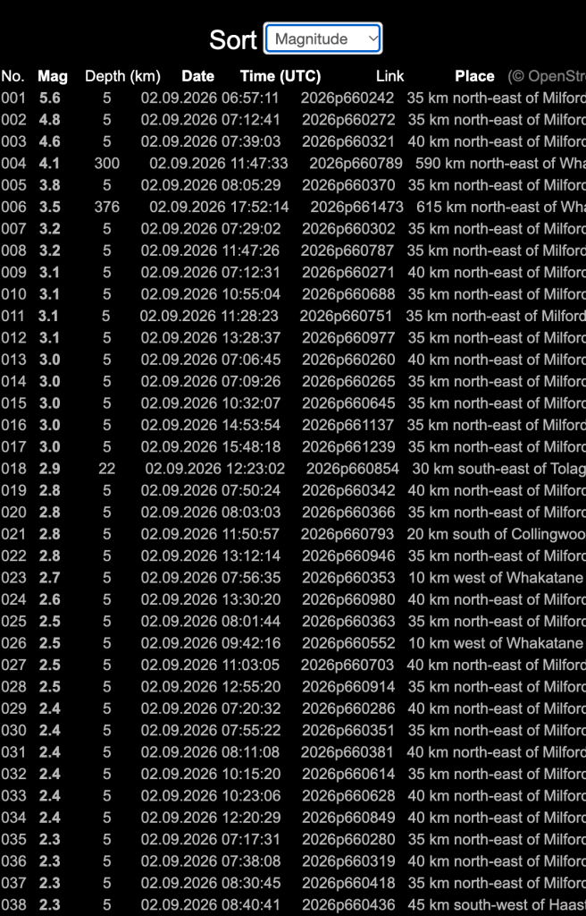
The graph below only shows the last hundred or so quakes – Screenshot taken at 6.57am
Some have been watching the earthquakes since Christchurch became fodder after the economic hit on the 4th September 2010.
Tomorrow is the 16th anniversary of the event that opened up NZs fault lines and awareness, making it another September to remember.
The people of Canterbury dug into area’s we hadn’t before, HAARP, CERN, Ice Neutrino in Antartica all came into the view of those that understood somethings didn’t make sense. The result is now most of are long past thinking these earthquakes are natural. Most are aware the earthquakes are no longer at any depth, the crust seems to have ripped and most quakes we see today are at these terrifyingly shallow depths (oxymoron?).
These new quakes are different. While watching central north Island erupt into multiple shallow quakes, the south Island of NZ had virtually none. Then something happened.
CERN was turned off in Geneva and almost instantly, the south island was back to full battle/shake on land. Prior to this fleets of UFOs (hundreds) were being reported all along the west coast of NZ travelling south and south east.
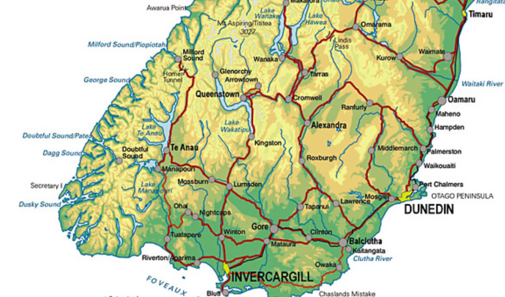
A previous quake in Te Anau, which is reasonably close to Milford Sound, bills itself as the gateway to Fiordland. More than 20,000 felt the overnight 5.9 magnitude earthquake north of Te Anau last July 17 2026. They were very lucky not to have had infrastructure damage or death after the massive shallow quake.
This is mountainous country with glaciers and snow hanging above valleys (ringing any bells?) The quakes were shallow. Now we have the Milford Sound/Piopiotahi event that is virtually identical to Te Anau quakes.
Note; Geonet has made their site virtually useless to get real time information from so I share this link from someone who cared to put something together that is semi useful NZ Live Earthquakes I will say this, the graph only shows the last 96(?) quakes. By the time you view this link, the big quake will already be gone from the public data. Unless you are sitting over your computer taking screenshots live, the data conveniently disappears and is hard to find – it’s a magic trick.
Lets look at the landscape of Piopiotahi, Milford Sound
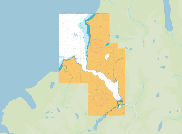
NZs Piopiotahi rocked by multiple large earthquakes at very shallow ‘depths’. Crust and aquifers now cracked, a never ending resource of water, just add a little rain to the mountain tops, and it is positioned south west of NZ’s hydro power stations in the Mackenzie Basin. Hey presto! Isn’t this a nice place for data centres?
It’s a magic trick.

Most of us understand the political arrangement with those that own space lasers (and incidentally literally reported today they are pretending they don’t yet have them) and very few understand that NZ’s quakes have much to do with offshore magnets.
Much love to the people that inhabit these areas, but none more than those that suffered huge loss in Canterbury where the crust was ripped and the aquifers polluted, not to mention the deaths of 22.2.11
Your thoughts please.
Discover more from Environmental Health Watch NZ
Subscribe to get the latest posts sent to your email.

Has the HARP rig been seen off the coast of these Sounds? Or is this no longer required? Was there any aurora lights, or other unusual observations seen prior to these shallow quakes. can you explain the turning off of CERN connection further please?
LikeLiked by 1 person
All important questions Jason and I will do my best to show you what we know. Blog coming later today.
LikeLike
When you say HAARP rig I would presume you are talking about the SBX X-Band Radar? It’s been a number of years since I have personally seen evidence of that rig or it’s siblings in NZ waters. The pulsed wave it puts out is unmistakable.
Are there any locals here who can answer Jasons question re Aurora lights either in Milford or Wellington?
Leading up to the sudden uptick of 4+ earthquakes that hit land land, some have reported a luminescent glow in the night sky. It is almost like it’s a full moon all the time, and only the larger constellations can be seen clearly. Dubbed the camouflage by some, it is really difficult to view the sky with this glare back. I’m in the boonies and it’s shocking to see what we can’t see all of a sudden.
The LHC was reportedly shut down on the 29 6 2026. Interestingly they called it the “long shutdown 3”. I have been collecting screenshots of the south islands quakes because they were so unusual. No quakes over about 3.3 even hit land for several months, the only ones being reported were offshore and anything big was up in the Kermadec Islands.
I will work out how to answer the CERN question with the screenshot images however I’m not able to add those here. as the comments section only attaches URL links and my links aren’t on line to attach. Also these “quake energies” have had me quiet discombobulated over the last weeks. I need a little down time. I will lay them up in a blog when feeling clearer. Meantime here’s the latest shake and bake for NZ. https://envirowatchnz.com/2026/09/05/more-quaking-for-milford-sound-and-new-zealands-capital-wellington-gets-a-jolt-overnight/#more-101009
LikeLike
Heard on MSM just now. Someone in Welly saying it felt stronger than the 5.5 it was reported as being.
LikeLiked by 1 person
Seasoned quake friends are saying these quakes are AT LEAST a magnitude higher than they the authorities are saying. How would they know that? Just ask anyone from Christchurch, Kaikoura or Seddon. They get these quakes down to the inth of a magnitude – years of being rolled.
LikeLike